|
|
Post by Tom Goodrick on Oct 6, 2008 9:30:40 GMT -5
The wind was different. That would affect the takeoff. Nothing affects the FD files except editing or copying new FD files.
If anyone else wants to fly the Baron 58P (pressurized and turbocharged) on this Fling, just drop me a note.
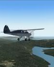
By the way, if you can, stay below any clouds so you can see the ground. But this can be tricky as it is in real life. It is hard to see the difference between a horizon and a mountain dissappearing into clouds. (Been there, done that).
|
|
|
|
Post by Allan_Lowson on Oct 6, 2008 13:03:26 GMT -5
Sad to say this may have been the fate of Steve Fossett, based on the location and strength of the aircraft impact.
|
|
|
|
Post by flaminghotsauce on Oct 6, 2008 21:41:06 GMT -5
I got busy flying Sunday. I flew the first leg in FS9 before church. Then, after church, I flew it again in FSX just to compare. I continued all afternoon and got about halfway between CNY and U07 before I stopped. I had to pause for something or other and saved. It's still there.
Impressions so far: FSX is way more brown terrain looking than FS9. I had to laugh when the trail-like small part of the river gave way to the blue water part, but the trail part still meandered through the blue water. Oh, FSX water looks really nice, too. Especially going up hill, over the rocks and back down the other side! ;D
I've been riding down low into the valleys. It's quite dangerous.
|
|
|
|
Post by Tom Goodrick on Oct 6, 2008 23:44:30 GMT -5
If you were flying Sunday morning, you obviously did not wait for my email which gave you the weather file and the flight plan.
Have fun.
|
|
n7rg
Member
Going Home to Alaska
Posts: 62
|
Post by n7rg on Oct 7, 2008 1:36:10 GMT -5
HI all
look like A fun flight. I flue 100 miles or so with the Piper Tripacer low and slow.
Tom I sent you a PM with my E mail address, for A copy of your flight plane.
also found 2 small files that made a big difference in the default Canyon. canyonlands_srtm30.zip
And colorado_lakes_project_2.zip.
Thanks for great idea
Richard
|
|
|
|
Post by hanspetter on Oct 8, 2008 16:55:13 GMT -5
I've done two legs in the Baron58P. When I started a taxied onto the middle portion of the runway. Should I go up to the "piano keys" and get the entire runway? Nah, a Baron should do fine anyway. That was the wrong choice. I barely managed to get airborne before I sank into a valley with some houses. I picked up speed and managed to avoid hitting anything and for a simulated flight I might have concluded that it was good enough. I didn't. I turned back, landed properly and used the entire runway for a second take-off. Way more stylish this time! I should have noticed the altitude the first time -- this is no sea level take-off and we need all the runway we can get.
There were clouds and wind. The next airport was in a valley with mountains shrouded in clouds. I dropped the gear and set flaps as I approached but i didn't spot anywhere to land. I cruised around with the gear down until I found the airport. In real life this would have been a bit too exciting with mountains all around. Low viz, low clearance and lots of mountains all around make no safe combination. (Is there a mountain hidden behind that cloud? Let's hope there isn't).
The next airport had a grove of pine trees in front of the runway. I guess that's what autogen does. To avoid the trees I had to land pretty far down the runway.
|
|
|
|
Post by flaminghotsauce on Oct 8, 2008 22:21:22 GMT -5
Yeah, I started without the flight plan because I had some free time before and after church, and I didn't check my email until later on.
I haven' t gotten back to it until tonight. I took off early from work not feeling well, and have been drinking tea, cocoa, and a hot toddy, so I figured I had the time to sit in the airplane, right?
So I flew a bit more in FSX from where I left off Sunday. I was in the Caravan for a while. The walls of the river canyons are getting taller and more difficult to maneuver. I got as far as PGA and parked. Next leg I'm probably going to take out my new Cessna 152. THe view is tremendous! I've been trying to get some screen captures, but I don't know how to do it in Vista/FSX. What always worked in Win2000/XP/FS9 doesn't do anything. I always used the print screen button and a photo would be waiting in my clipboard.
I loaded up the FS9 flight plan, RW, and Mooney situation tonight, finally. I had previously worked on FS9 to get the best possible terrain and eye candy with the frames around 25 ish. Really cranked it up. I had it flying smooth too. But the flight plan and RW crushed the frame rates. I was in single digits. I did a bit of back and forth with FSX and FS9 was worse looking AND frame rates. I'll have to tone it all back down to use the flight plan.
I think I'm going to continue flying FSX, and dabble with the FS9 some more.
|
|
|
|
Post by Allen Peterson on Oct 8, 2008 23:39:54 GMT -5
I am also at Page now. I had an interesting flight down Cataract Canyon, actually down in the canyon abour 800 feet agl. I had the GPS set on the 5 mile range so I could get a good look at the canyon direction. But I missed where the river turns due east to UT03 and continued on southerly is what looked like the main canyon. Soon I noticed the walls getting closer and the floor rising. I had to go to full power and keep following the canyon and climb to about 9000 feet before I could get out. The canyon was too narrow to turn around in. I flew back to UT03 and then on to Bullfrog Basin and landed OK.
So this is fun. I'm looking forward to getting down in the canyon again past Page.
|
|
|
|
Post by jerryluke on Oct 9, 2008 0:17:54 GMT -5
I flew the first 2 legs tonight in the B350. I filled the main tanks but left the aux tanks empty. I set 50% power after takeoff and she settled in nicely. I tried to follow the river as much as possible. Great fun. This is a lot of plane to maneuver around the hills. Looking forward to getting into the canyon. Fog on takeoff, then just puffy clouds. It's a real treat to fly on manual, no auto pilot. I had to calibrate my joystick!
|
|
|
|
Post by johnl on Oct 9, 2008 5:20:50 GMT -5
Finally settled on a Percival Proctor for the fling. On the plus side, it's British, good-looking, comfortable, well-behaved, has the delightful sound of the very reliable DH Gipsy Queen engine, and is painted bright red (which should help the search parties). On the minus side, it's a bit slow, especially at 8000'+, and being older than me lacks such refinements as radio navaids and an autopilot (I have fitted a transponder). Flew down the RH side of the river valley, mostly about 800' above the surface, diverting to fly T&Gs at GWS, RIL, and another airfield whose name I've forgotten, and got down safely at Grand Junction. Very enjoyable, though I suspect that I won't be able to get a decent cup of tea here.
|
|
|
|
Post by Allan_Lowson on Oct 9, 2008 19:02:25 GMT -5
I can recommend the Grand Vista Hotel in grand Junction - just outside the airfield and the meatloaf and local burgundy in Oliver's Restaurant will make up for any lack of stewed leaves! Make sure you look up Dianne in Oliver's - she likes to visit with visitors from Europe.
In Moab the Brewery does great meals too, I'll see if I remember to wear My Elephant Hill Hefeweizen T-shirt while flying by.
Should get started at the weekend, currently going through a/c to find low panels so as not to block out the scenery - the Twin Comanche has too many of those confusing dials and buttons in the way for scenic flying.
|
|
|
|
Post by Tom Goodrick on Oct 9, 2008 19:07:32 GMT -5
[This was written yesterday (10/8). I have not beem able to get on this Forum for more than 24 hours. Don't know why.]
I can't get onto the Forum this evening because we've had a lot of hard rain today and the phone lines are all screwed up. But I wanted to pass along to you the problems I have had landing at U07 and KPGA airports on the Fling. In each case I was following the river at very low altitude. But the airports are on elevated terrain. I could see from the map that they were in line with my flight path. But I could not see them from 5 miles out. The solution was to climb to 1000 ft above their published altitude 4167 for U07 (Bull Frog Basin) and 4316 for Page, AZ. Then I could make a normal visual approach and a decent landing.
I am flying the Mooney Bravo. I stopped first at Glenwood Springs and then flew direct to Bull Frog Basin. Then we stopped at Page for lunch at the Pizza Hut. John should try the Fiesta Family Restaurant one mile from the airport for a decent cup of tea. Next is the long Grand Canyon stretch.
So far I have only a brief encounter with low clouds. I think it was just south of Rifle that I encountered clouds as I entered a canyon. I tried to keep low but was ready to climb if needed. After a brief entry into the canyon, I decided to climb 4000 ft as fast as I could. Just after starting the climb I passed out of the cloud and could see no other clouds below or around me. I resumed my low altitude flight.
Most of my flying has been on manual control, trimmed at about -2.9 degrees for 159 KIAS. It stays very level as I do gentle turns to stay with the river.
At Page the dam is an ugly thing that rises up from the land on both sides! Microsoft really messed up the terrain in this area. They can't seem to grasp the idea that the terrain near the river on one side of a dam is higher than on the other side where the canyon is deeper. The same thing can be seen other places such as the Tennessee River. It is too bad. They have messed up some good scenery.
|
|
|
|
Post by Allen Peterson on Oct 10, 2008 1:22:38 GMT -5
Tonight I flew from Page to Grand Canyon - GCN, mostly down in the canyon at 4200 - 4500 ' at about 125 kts. That is about 1400 - 1700 ' above the river, and puts me down into the narrow lower V canyon. It is about as low as I care to go, especially when the walls are so narrow. And when flying that low in the canyon I have the AP on ALT, and the GPS on the 5 mile range.
When landing at GCN I had to find a branch canyon long enough that I could climb from 4500 ' to 7500 '. That worked OK but I goofed up at Grand Canyon West - 1G4. The branch canyon I selected wasn't long enough and the floor rose faster than I could climb, and guess what? I crashed! Flying UP canyons can be bad news. Anyway, I put the plane at 1G4 and flew to 0L9 where I'm spending the night. I suppose there is a Big Mac around someplace.
|
|
|
|
Post by jerryluke on Oct 10, 2008 10:47:47 GMT -5
Reached Grand Junction last night, and circled the city for a bit, looking at the scenery. Then I found the river again, and headed back out, but guess what? I was going back the way I came! Heeehooo ha ha....i looked at my sectional chart (I have a Denver sectional chart-very useful), and re-oriented myself, consulted the gps, and swung back onto the correct heading. Great fun! I love holding altitude and heading via the stick (no AP) in turbulent air.  |
|
|
|
Post by flaminghotsauce on Oct 12, 2008 19:18:37 GMT -5
I did some more flying this evening. I took off from PGA in the 152 and followed the creek! THe dam there was interesting. FSX thoughtfully includes mist from the invisible falling water, so the mist kind of floated out horizontally from near the top of the dam! Nice span bridge there as well. I was trying to stay a bit higher as I got along to get more scenic views but clouds kept creeping in and I had to duck them. I was not wanting to get down deep into the cracks and crevasses as they seemed too tight for comfortable maneuvering.
As I got near GCN, I realized the airport was higher than my current altitude, and I was having difficulty climbing. I don't have a fuel flow meter in the 152 and had to mix by RPM. I had to turn down river a bit to get more climb time but it worked out okay. I had to fly through a cloud at one point and I could see nothing.
AFter landing there, I set up the next leg as a two airport leg. I also pulled the little red line around the river bends to make multiple waypoints that would more closely follow the river. I also decided to change planes. I jumped into the Maule, which I have not touched yet, so it was a bit rough. My tail-dragger skills are woefully inadequate but I managed to take off without crashing.
I managed to get as far as Grand Canyon West (Ig4) before the sun got too far down and the shadows were getting too long. My landing was terrible, but again, no crash. The runway was in no danger from tire marks outta me! I don't see any services around, and the building out back looks rusty and decrepit. No dinner here!
I'll have to change the time of day to morning when I take off.
|
|