scottanderson
Member
"North, South, East and West" via the AM-70 connector service
Posts: 6
|
Post by scottanderson on Jan 4, 2011 14:37:53 GMT -5
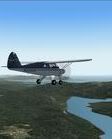
Since I am from Kentucky (actually, my parents live in Madisonville, about 5 miles from 2I0, and I went to high school near there), I have a special interest in the historic Bluegrass Airlines. Found this info about the original Ashland Airport, which is the one that BGA flew to, *not* KDWU, which didn't open until mid-1948, about two years after BGA shut down. Scott Anderson BGAM006 Attachments:
|
|
scottanderson
Member
"North, South, East and West" via the AM-70 connector service
Posts: 6
|
Post by scottanderson on Jan 4, 2011 14:38:50 GMT -5
More photos of the original Ashland airport. Attachments:
|
|
scottanderson
Member
"North, South, East and West" via the AM-70 connector service
Posts: 6
|
Post by scottanderson on Jan 4, 2011 14:39:58 GMT -5
First Day Cover for the opening of the Ashland airport. Attachments:
|
|
|
|
Post by Bill Von Sennet on Jan 5, 2011 15:36:08 GMT -5
Thanks Scott!
Information on the historic Bluegrass Airlines is hard to come by.
|
|
scottanderson
Member
"North, South, East and West" via the AM-70 connector service
Posts: 6
|
Post by scottanderson on Jan 7, 2011 19:21:18 GMT -5
I've always been something of an amateur historian. I'm going to stay on the trail of more information. My next move on this is to go nosing around Bowling Green and see if I can find some more particulars on the organization, equipment and employees of BGA.
|
|
n7rg
Member
Going Home to Alaska
Posts: 62
|
Post by n7rg on Jan 11, 2011 5:43:25 GMT -5
Hi all with the ashland 34 st information, thought I would see if I could find whare the airport would have been in the flight sim. Found ashland on google satellitemap and inported into S builder. The red line is 34 ST and the yellow line is along side the old runway you can still see some of the old runway in spots. so I lined up AF2 cad on one of the spots and place a 3000 foot runway. I also found out it lined up with the Huntingtion radio range on the 317% radial. Nice place to make NDB approachs nonthing to run into over the river, just a little weat. The Attachment has a af cad and a execlude file if some one would like to see the old airport. 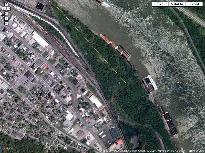 If there is some interest, I would build a complet scenery for it 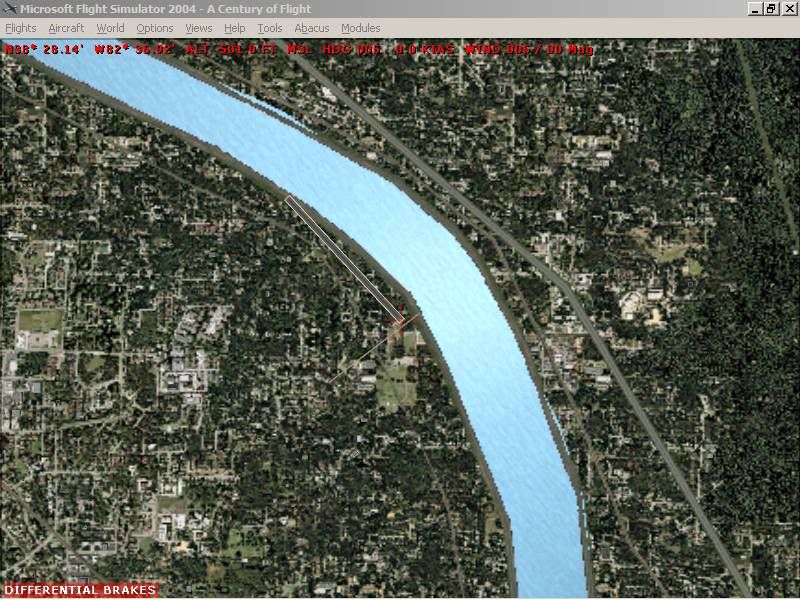 Richard |
|
Ed Burke
Member
Healthy living is fine, but it's having fun that keeps us going!
Posts: 433
|
Post by Ed Burke on Jan 12, 2011 22:04:48 GMT -5
Good stuff Scott.
No sign of your attachment Richard, I'd like to put the old field into the sim. Incidentally the 1996 GE imagery, although b&w, has a lot more interest due to the relative lack of vegetation.
Ed
|
|
n7rg
Member
Going Home to Alaska
Posts: 62
|
Post by n7rg on Jan 14, 2011 3:20:15 GMT -5
Hi Ed I made a file to move the river, but you will need to disable files in the fs9\scenery\namc folder. would please post the 1996 GE imagery. let me know if you want the river files Rich Attachments:
|
|
Ed Burke
Member
Healthy living is fine, but it's having fun that keeps us going!
Posts: 433
|
Post by Ed Burke on Jan 14, 2011 17:19:18 GMT -5
Thanks for attachment Rich. In GE just click on the clock in the tool bar and pull the slider to the date. I'll post it if you have no joy. Ed
|
|
n7rg
Member
Going Home to Alaska
Posts: 62
|
Post by n7rg on Jan 16, 2011 23:50:15 GMT -5
Hi ED
well I finally got GE downloaded took 4.5 hours + 1/2 hour to down load a Picture. Thanks for the info
Rich
|
|